Tour du Mont Blanc
I recently hiked the Tour du Mont Blanc with a friend of mine, and I must say, it was one of the most beautiful hikes I’ve done. I cannot recommend this hike enough, and so I thought I’d write a little blog post to help you plan your own TMB hike!
As a heads-up, this was my first hut-to-hut hike and only my second multi-day hike after the West Highland Way. Also, when I planned my TMB I heavily relied on this blog post from Well and Good Travel. I’ll shorten the name to WAGT for the rest of this post, because it’s a lot to type and I’m lazy (I am a programmer, after all).
Planning
My friend and I hiked the TMB at the end of August, which I recommend you do as well. The weather was still pretty warm (sometimes too hot for my liking) and it only rained on 1 of the 11 days (yes, we hiked it in 11 days - more on that later).
We also booked the refuges on our own, just like WAGT did. I recommend you do the same, as it’s not that hard to figure out and it’s really expensive otherwise. We started booking in September, and by then some refuges had already been fully booked, so if you can, I’d recommend booking it even earlier than that. Or just bring a tent :)
Day 1: Trient to Argèntiere
We started our hike in Trient, which would normally be the second-to-last day. We’re Swiss and wanted to have a “quick” travel time, so we decided to stay in Martigny, and then go up to Trient with the bus. I personally liked Martigny; I wouldn’t call it the prettiest city in the world, but it has everything you need. Next time, I would definitely stay in Chamonix, just because I liked it so much. If you can, I’d definitely follow the advice of WAGT to stay in Chamonix before and after your trip.
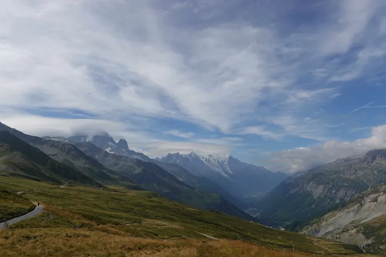
On our first day, we hiked into France via Col de Balme. The first ascent was pretty steep, but totally doable. Once you arrive at the refuge that is there, you will be amazed by how beautiful everything is. You will also see the Mont Blanc massif for the first time (if the weather allows it…)!
Once you pass the refuge, you’ll notice that you’re actually in a ski resort. This was a first for me, I found it really interesting how steep the slopes actually are. We went up to the Aiguillette des Posettes. It also had great views, but the path there was pretty technical. Nothing impossible, but you definitely had to watch your step.
The descent into Tré-le-Champ / Argèntiere was pretty brutal and I was definitely glad that I brought hiking poles with me.
Stats
Distance: 15.4km
Elevation: 1130m
Descent: 1130m
Night 1: Gîte Le Moulin
Once we were in Argèntiere (or Montroc, to be specific), we checked into our first accommodation. I can definitely recommend this refuge! The rooms were for 4 people, and everything was clean. The hosts were really friendly and the food was great.
Since it was like 14:00 when we arrived, we decided to go to Argèntiere via bus. You can just tap in with a card when you’re going on the bus. There is a small ice cream stand at the town square. Can definitely recommend that one.
Day 2: Argèntiere to Les Houches
Today was the day we tackled the famous ladder section. Funnily enough, at dinner we spoke to a guy who had this stage left to go. I was talking with him about the stage and he always seemed to ignore my comments about the ladder section. Turned out he didn’t even know that the ladder section was a thing, and probably thought I misspoke (since English isn’t my first language, and I have a pretty big accent). He said he would’ve skipped it if he had known.
To be perfectly honest, if it were my last day I probably would’ve skipped it, but as this was only our second day we kinda had to and wanted to do it. I have a bit of a fear of heights, but I can assure you it’s easily doable. Just take your time and look at the ladder or at your feet. In the end I didn’t have any problems, but it was kinda exhausting nonetheless.
Once you finish the ladder section, you can go either up to Lac Blanc or directly to the cable car. We did the Lac Blanc variant because WAGT recommended it in her blog. We didn’t really like it to be honest. In her blog she said “a bit of elevation gain”, which turned out to be the understatement of the year. I think it’s comparable to the ladder section again. At Lac Blanc there is a hut where you can eat some tasty tarts, but other than that it’s not that exciting. Also there were a lot of day hikers there, which made the ascent and descent pretty slow. If you have enough energy, I think it’s pretty doable, but don’t expect anything crazy.
After Lac Blanc, we went to the La Flégère cable car. You can also continue to the Planpraz cable car if you want to, but we decided we had enough hiking for the day, and we wanted to explore Chamonix a bit.
I really liked Chamonix, I definitely have to go back there in winter. It’s a beautiful little city and you can kinda feel the sportive vibe, it’s hard to explain but I think you’ll get what I mean once you get there.
Stats
Distance: 10.3km
Elevation: 1100m
Descent: 550m
Night 2: Gîte Michel Fagot
This refuge is in Les Houches, just a bus ride away from Chamonix. I can also recommend this refuge; the food was pretty tasty and the rooms and shower were really nice. You also have a sink and washing line available to wash your clothes. Just note that they only take cash. There is an ATM nearby, but apparently the fees are pretty bad, so I’d recommend getting cash in Chamonix.
Day 3: Les Houches to Les Contamines
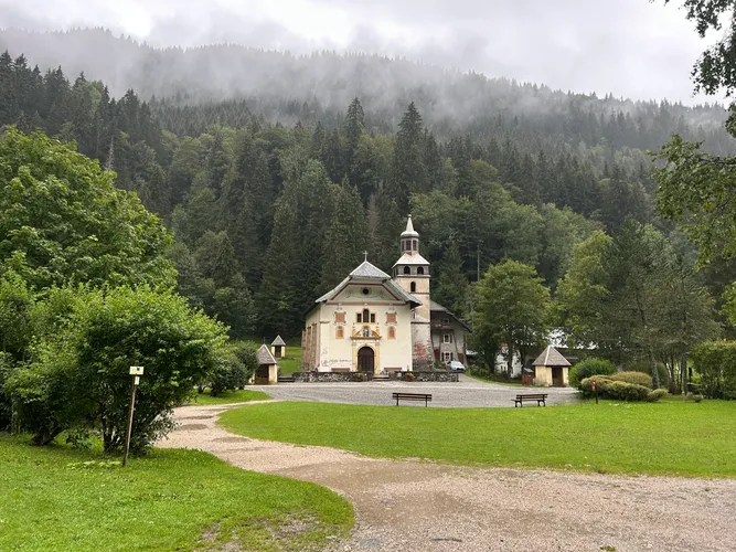
This was a quieter, less scenic day for us, but the towns along the way were all very pretty. Some kids and their mother were selling cookies to passersby, we took the opportunity and we weren’t disappointed!
The last 5km or so were a bit of a struggle, especially the last 100 meters. The first thing we did was getting pizza at “Au Bistro Gourmand”. They were really delicious; if you have the chance, I’d go there.
I wanted to get some money from the ATM because the next 3 days would have been with pretty much no service. Unfortunately, one of the two banks there closed and the other one had issues with the ATM (which seems to happen rather often), so that wasn’t an option either. I had to get cash at a small shop; the fee was understandably pretty high (like a 5€ fee and you had to buy something for 2€ for a maximum of 60€ cash if I remember correctly). So if you have a chance, top up your cash in Chamonix and you should be good to go.
Stats
Distance: 16.2km
Elevation: 1060m
Descent: 890m
Night 3: Gîte / Camping le Pontet
As the name might suggest, this refuge has a campsite attached to it (or the other way round). Dinner was pretty good and the breakfast had a lot of options, which I really liked. This was the last time we saw people our age (~20 year olds) at our refuge; after that there were mostly 30 year olds or older. I suspect this might be because we weren’t camping, so there’s a good chance you’ll have a totally different experience.
I’d recommend staying at this refuge if you can; I think this was one of the ones which were mostly booked when we did our bookings.
Day 4: Les Contamines to Refuge des Pres
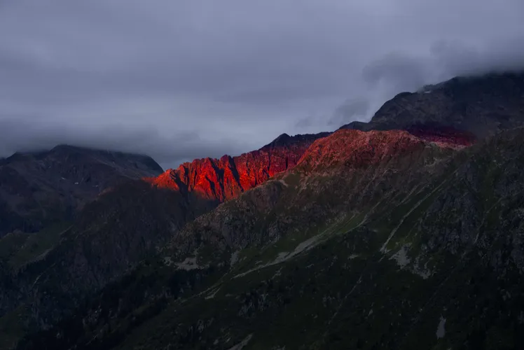
Day 4 was a pretty short but intense day. It rained quite a lot and we were soaked by the time we got to the refuge. Although the day is quite short, the ascent up to the refuge is quite steep, so get ready for that. Unfortunately, due to the weather the visibility was quite poor as well, although it got better in the afternoon.
Stats
Distance: 6.58km
Elevation: 780m
Descent: 20m
Night 4: Refuge des Pres
This was one of my favourite refuges. The rooms are really nice and the showers are great as well. The hosts are also very kind and the food was great. They seem to offer fondue, but we didn’t get to try it, although we’d have devoured it given the chance.
As I said, there is no service there (or just a tiny bit outside the refuge), so prepare for that. Surprisingly - although there is no service - you can pay with card. I wouldn’t rely on it if it’s really bad weather, but it was nice to relieve some of our worries about not having enough cash.
Day 5: Refuge des Pres to Refuge des Mottets
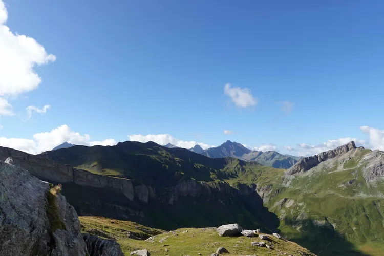
This was our first of two big deviations from the standard route, since we did the Tête Sud des Fours variant. Basically, instead of going into Les Chapieux like WAGT did, we went over the Mont Blanc massif to the other side. We didn’t do this voluntarily - since the refuge in Les Chapieux was already fully booked - but I didn’t regret it. There were some really nice views on the path and overall a fun hike to do.
Also, this was the first time we saw and heard marmots. Marmots are one of my favourite animals, so this day was very special for me :)
Stats
Distance: 15.8km
Elevation: 990m
Descent: 1060m
Night 5: Refuge des Mottets
All in all a good refuge, showers are really small and you can’t put your stuff anywhere. The room for dinner was really big and pretty full while we were there. Food was okay, and we met some really nice people there. We had a room for 4, which was a bit small but totally manageable.
Also, no service. We had already paid everything, so I don’t know if they accept card, but I highly doubt it.
Day 6: Refuge des Mottets to Cabane du Combal
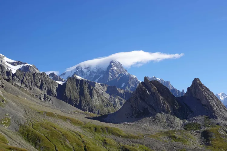
This was the most beautiful day of the entire hike. You’ll be crossing into Italy via the Col de Seigne. Once you’re up there, just admire the beauty everywhere. I was stunned by how breathtaking the landscape was. I think this stage could also be a cool ski tour, but that’s besides the point.
A lot of people stayed in Rifugio Elisabetta. I think if you come from Les Chapieux, that would be an appropriate place to stay, but I haven’t really checked it out.
We continued to Cabane du Combal. Also a lot of day hikers there. The staff was kinda rude at the beginning, but were really friendly later. I assume they were just stressed from the sheer amount of people (which is understandable).
There is also Lago de Miage right at the refugio. When we went it was pretty much non-existent, but the rocks and debris from the glacier were pretty impressive.
Stats
Distance: 11.9km
Elevation: 700m
Descent: 610m
Night 6: Cabane du Combal
To be perfectly honest, I didn’t really like staying here. I can’t really explain why, because the food was really good and we had private showers and toilets (shared with our roommates, this was a 4-bunk room again). If you come from Les Chapieux, I think it makes sense to stay here, but for us it was a pretty short day. We arrived at like 12:00, and the next day wasn’t that hard. So I guess it depends on which route you do.
There is some service at Lago de Miage, which we really enjoyed. You can pay by card at the refuge.
Day 7: Cabane du Combal to Courmayeur
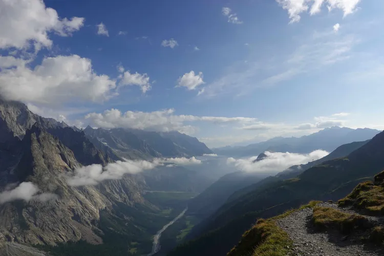
This was also a stunning day of hiking. My legs gave me a hard time on that day, although it wasn’t really a challenging hike. The only exhausting bit was the ascent, which was over pretty quickly. We randomly had a cow walk the trail alone (?). I guess everything’s possible in Italy.
We were - again - quite early to the refuge. We wanted to go down to Courmayeur and asked the hosts if we could deposit our bags somewhere. They didn’t really treat us that kindly, which was a bit of a bummer. It got better once we got back from Courmayeur, so it wasn’t the end of the world.
Stats
Distance: 7.8km
Elevation: 530m
Descent: 550m
Night 7: Rifugio Maison Vieille
We didn’t follow the advice of WAGT to take a hotel in Courmayeur, which we went on to regret. Don’t get me wrong, it was an okay refuge (although most of the toilets were just holes). If it wasn’t so close to a city, I’d recommend it. But I can’t really justify staying there if you’re paying 80€ per person. Seriously, get a hotel in Courmayeur. This way, you can enjoy the city without having to worry about catching the last cable car (which isn’t really that cheap either). Dinner was okay but nothing crazy.
Day 8: Courmayeur to Rifugio Walter Bonatti
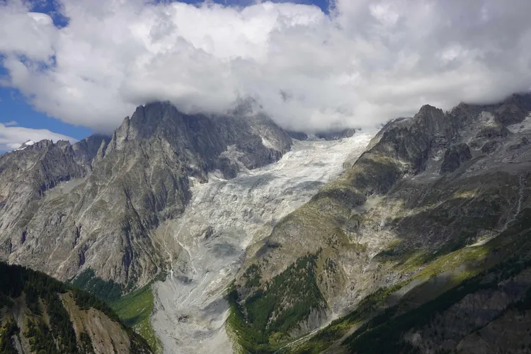
We started this day by taking the cable car down to Courmayeur. I’d recommend it, although it’s on the expensive side (I think we paid 10€ per person). You can walk all the way down, but the trail isn’t particularly scenic and you’ll already be doing plenty of walking and elevation gain. Hiking the first 10 minutes or so through Courmayeur is very cool; after that it gets really steep. It’s nothing you haven’t done before, but still quite hard. When you’re by the hut at the top, you’ll probably have noticed a hill by now. Don’t worry, you have to walk around it, not over it. Afterwards, you’ll see a really big glacier. That’s very cool to see, although we’ve seen some already. The last part is very hard again, as the Rifugio is a bit higher up than the trail. We made it fortunately (although not without cursing).
Stats
Distance: 12.9km
Elevation: 1130m
Descent: 320m
Night 8: Rifugio Walter Bonatti
The Rifugio is pretty new; you’ll get a coin on check-in for hot water, which was a first for me. We went into the large dormitory, which is just beds next to each other without any space between. That wasn’t really a problem for us, but you’ll be sleeping with around 30 people in one room, so the probability of someone snoring is pretty high. Also the floor is really squeaky, so if someone needs to go to the toilet in the evening, you’ll know it (depending on how deep you sleep). It isn’t really a dealbreaker for us, but next time I’d choose a 4-bed dormitory or something of that size.
I unfortunately have to disagree on the food side with WAGT. Our dinner was pretty poor, and the buffet in the morning is pretty poorly organized. But you’ll definitely get full, so that’s nice.
Day 9: Rifugio Walter Bonatti to La Fouly
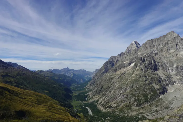
Day 9 is going to be a tough one as well. You’ll be crossing into Switzerland via Grand Col Ferret. Just take your time, as there is no rush for anything. Funnily enough, the hardest part for me was the end, because it seemed like we were close to La Fouly, but after 10 minutes of walking we noticed that we still had some way to go. Repeat that 4 or 5 times and you’ll be pretty annoyed by the end. Also, I had worked up a real big appetite, so this only accelerated my frustration.
But once we were in La Fouly we were really happy. We went straight to our refuge and ordered some lunch. I could swear that was the best schnitzel of my life. We were really happy with lunch, although we definitely noticed that we were in Switzerland once we looked at our bill.
For me, it was great to be in Switzerland; it kinda felt like we were slowly closing out the hike.
Stats
Distance: 21km
Elevation: 1020m
Descent: 1610m
Night 9: Auberge des Glaciers
This refuge was great. You had a small store underneath it with everything you’ll need (at least food wise). I was really happy to drink my first Rivella! The dinner was also pretty good and the morning buffet was very extensive.
On our floor, we had 2 showers, which doesn’t sound bad. Unfortunately, the showers were in a shared room and had glass panels, which meant only one person could shower at a time effectively. But since there weren’t a lot of people on our floor, we managed to do it.
Aside from that, can recommend!
Day 10: La Fouly to Champex-Lac
This day isn’t quite comparable to anything before. You’ll be walking mostly through Swiss towns (which are all really pretty) and at the end you’ll be walking up to Champex-Lac through the forest. I really enjoyed the first part, but walking up to Champex-Lac, I once again got really frustrated.
Don’t get me wrong, I really enjoyed the hike and would go again sometime in the future. Having completed the West Highland Way just two weeks prior - making this 18 total days of trekking in four weeks - I was reaching my limit. Hiking was starting to feel like a chore, and I felt a bit saturated by all the scenery.
Anyway: After arriving in Champex-Lac, we first admired the lake a bit and then ate at Le Cabanon. They had some really good food (we had the burgers, definitely recommend). Afterwards, we went to the refuge, noticed check-in was only at 16:00 (it was 14:00 by then), so we decided to go swimming. It’s pretty cold in August, so be prepared :)
Stats
Distance: 14.3km
Elevation: 580m
Descent: 710m
Night 10: Pension en Plein Air
The rooms were great for a refuge at this price. We had to pay by cash (or with Revolut Pay for whatever reason, it’s not common in Switzerland). I can’t really say much about the dinner, as when we walked in it looked so unappetizing that we decided to go back to Le Cabanon. The breakfast was okay, I’d say it was pretty average.
Day 11: Champex-Lac to Trient
The last day! Normally you’d go from Champex-Lac back to where we started in Trient. However, due to our dwindling motivation and our (or at least my) more than donezo legs, we decided to directly hike down to Martigny. Also, as it was raining (we even heard some thunder) we think we didn’t miss anything and we would’ve had to wait 4 hours for the bus down to Martigny. It was also quite interesting to hike in a more urban environment after being in nature for the last 10 days.
It was great being back in Martigny. We went into the first place that served pizza and they were great! It was somewhat weird to see the place you were just 10 days ago, but it felt much longer. We booked the same hotel we did when we arrived and for dinner we went out for fondue. I can’t recommend this enough, it was such a great feeling after seeing it so often in the huts and now we were able to eat it ourselves.
This was it! Our Tour du Mont Blanc adventure was finished.
Stats
Distance: 11.9km
Elevation: 120m
Descent: 1100m
Some Tips I learned along the Trail
- You don’t technically need house shoes in your pack, as most huts provide them, but I didn’t regret bringing my own.
- Always bring a sleeping liner! This made it so much more comfortable, and you have an extra blanket to work with if it’s too cold / hot.
- I carried around 2 liters of water with me and didn’t have any problem, although it was pretty warm. I wouldn’t go with less than that. There were fewer water refill stations along the path than I expected.
- Bring hiking poles! My friend didn’t need any, but for me it was really helpful to stay in the rhythm and take the load off your knees on the descent.
- I went with 8.6kg in my backpack (with water). I think the TMB is easily doable with that weight, although I didn’t bring a lot of clothes, which I regretted toward the end (my shirt and socks definitely needed a wash). My friend went with 11kg, which is quite a lot and had some unnecessary weight included. I’d go somewhere in between, maybe bring 2 hiking shirts instead of 1.
- When I started the hike I did a lot of stretching directly after the hike (max. 20min after), and I’d recommend you do that too. At the end I stopped doing it, and I definitely noticed.
- WAGT recommends booking a baggage transfer, which I don’t agree with. It can get pretty expensive, and you’ll have to carry your stuff anyway for 2-3 days at a time. I don’t regret it a bit not booking one. But if it’s a relief for you, then book it. Don’t let pride (or me for that matter) ruin your trip by forcing you to not book it because “it’s easier that way”. Go with your gut, if it feels right for you then it’s worth doing!
Conclusion
As I said, next time I’d start in Chamonix and do the 10-day variant as well, maybe with a tent, we’ll see (probably not, I was quite relieved to have a normal bed at the end of the day). We spent around 3000CHF (3700$ / 3200€), which is quite a lot, but for us it was definitely worth it. All in all our route was 168km long and had 8600m in elevation, which is a bit over the official numbers.
So that’s about everything I can say about the TMB. I hope I answered some of your questions and maybe even motivated you to go yourself. If you’re unsure: Just do it! It’s a really approachable hike, and you’ll meet a lot of very nice people.
Thank you so much for reading my blog!
~ C0RR1T